
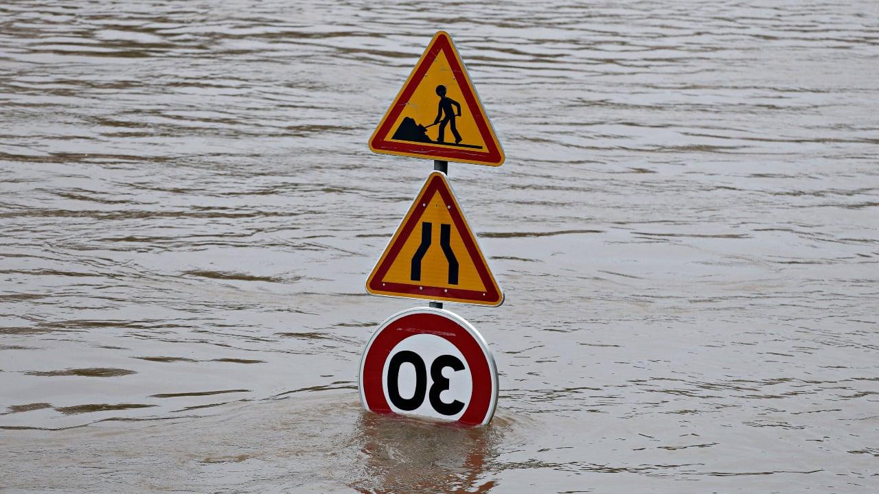
The French landscapes shaped by rivers, rivers and coastlines have long been perceived as natural assets. But as the climate is disturbing, these territories become the first lines of impact of an increasingly frequent phenomenon. Diluvian rains, sudden floods, unexpected overflows redefine the contours of hydrological security. To respond to this new reality, the map of the flood risk recently unveiled by the IGN offers an unprecedented reading of the national territory, where a quarter of the population already lives in the exposed zone.
In this context, France faces an unprecedented chain of extreme events. Between lightning floods, marine submersions and urban streams, water becomes a diffuse, unpredictable threat, which affects both coastal areas and river valleys or densely urbanized peripheries. The flood of the Sauldre in 2016 had already highlighted this new vulnerability, heavily affecting the flood district of Romorantin-Llanthenay, however designed according to innovative hydraulic principles.
The multiplication of these phenomena leads to a progressive awareness. According to the Ministry of the Ecological Transition quoted by Liberation, one in four French people currently lives in an area exposed to a risk of flood, by overflow of rivers or by marine submersion. And this estimate could prove to be undervalued as runoff is progressing in sectors so far considered as safe.
 © Alice Clair via Liberation
Flood risk map.
The flood risk card redefines territorial priorities
To respond to this growing threat, the National Institute of Geographic Information and Forestry has just published a detailed map of the risk of flooding throughout the territory. This document, unprecedented by its precision, compiles satellite data, topographic surveys and climatic models in order to draw up a specific inventory, common by commune, areas in Fort Aléa.
Atlas 2025 published by IGN is based in particular on LIDAR HD program technologies. Thanks to this 3D cartography, it becomes possible to model with great finesse the trajectories of precipitation, from their point of impact to their evacuation to collecting basins. This level of detail not only identifies areas at risk, but also to simulate the effectiveness of future facilities, whether urban or natural.
This new tool makes the fragility areas visible hitherto poorly known. In some municipalities in Val-de-Marne, for example, modeling highlights the risks of potential water heights greater than two meters in the event of a major flood. These data are crossed with electricity, drinking water and gas networks, in order to measure the potential impact on vital infrastructure.
The report underlines that Rouen, Paris or Lyon appear clearly on this map. In addition, coastal and ultramarine areas, from Reunion to the Camargue, also appear. This distribution does not only depend on the old river lines. In reality, it also illustrates the impact of urbanization, the artificialization of soil and the progressive disappearance of infiltration areas.
Governing with data, anticipating to avoid disasters
The publication of this card illustrates a larger movement towards adaptation to climatic risks. In addition, the use of data becomes an essential foundation of this evolution. Thanks to cartography, communities, town planners and help now have concrete tools to anticipate. Citizens, too, access a better understanding, which promotes collective preparation in the face of crises.
As reporters report, this new generation of visual representations is not content to illustrate the past. It is used to project future scenarios by integrating the forecasts of a climate at +4 ° C, the reference trajectory defined by the national plan for adaptation to climate change. This prospective vision upsets town planning, but also mentalities. It imposes a culture of risk at all levels of society.
The Minister of Ecological Transition, Agnès Pannier-Runacher, insists on the need to rethink the development policies in depth. This supposes to accept that water is not an enemy to channel, but a force to integrate in the design of cities and infrastructure. Local initiatives such as the restoration of wetlands, the designing of soils or the installation of rural hedges are part of this resilient approach, based on nature.
If the Centennial floods remain rare, the lower size phenomena become more frequent, more expensive, and sometimes just as destructive. Anticipating, today, no longer consists in imagining the exceptional, but to manage the inevitable. And in this collective task, the map becomes a weapon of knowledge as essential as an evacuation plan.

With an unwavering passion for local news, Christopher leads our editorial team with integrity and dedication. With over 20 years’ experience, he is the backbone of Wouldsayso, ensuring that we stay true to our mission to inform.


